Why You Should Go Hiking At Mt Romelo In 2019
Written and updated by Dezza, 14 January 2019.
Are y0u looking for somewhere to go hiking near Manila that isn’t too difficult? If you are an intermediate hiker, then you should check out Mt. Romelo. Please read below for more details.
This weeks adventure we saw us staying in the province of Laguna. With our last trip being to Hidden Valley Springs Resort in Laguna province, there were a few of us who wanted to get back out into the forest and go hiking.
Naturally, if you go trekking through the rainforest on the outskirts of Manila, you will inevitably find some fantastic waterfalls. After doing my usual research, I came across a place known as Mt Romelo.
Mt Romelo certainly appealed to me because unlike the hike we did to Buntot Palos Falls, the hiking trails of Mt Romelo were said to be perfect for beginners. I also read that there were about four waterfalls that you can trek to. This sounded ideal.
Just like our last Deztiki Tour, we didn’t have an overwhelming response from friends. That was fine as that meant there was no need to hire a bus which is good for Laguna travel.
Of course, we still packed the obligatory esky full of beer which we packed away for good measure. This time I was only 5 of us so that made it much easier to coordinate things.
So after taking a month off in between our last day trip, it was time to get moving again.
Finding Mt Romelo Easier Than We Thought
The blog I had read about Philippines destinations that spoke of Mt Romelo said that the landmark to find the entry point of the trail was a little bit difficult.
We were told to look out for a place called Trois Restaurant in Siniloan Laguna. In true Pinoy fashion, I wasn’t sure whether this would be a small canteen that would be hard to find or what to expect.
I was able to locate the place on google maps so I felt pretty confident that we would find it without getting too lost. Luckily the signage pretty clear and we didn’t have too much trouble finding Trois Restaurant.
We parked our car and there were a couple of local people there who pointed us in the right direction to go to the registration area. The walk to the registration area from where we parked the car was only about 10 minutes.
It was part of a community centre in the area and not too difficult to find. So we rolled up to the registration area, paid our registration fee and were assigned a guide. Once this was done, away we went.
Let The Journey Begin
The first part of the hike is fairly easy as you are basically just walking through a local village. The terrain is pretty flat and most of the roads and paths are either paved or in pretty good condition.
After about half an hour you get to the base of the mountain and that’s where the incline begins. From there on the hiking trail isn’t very steep, however, the trial itself was in bad condition in some places.
We noticed that there were some people riding horses along this trail which explained why the condition of the trial was bumpy and uneven in parts. There is some spectacular scenery on this trail.
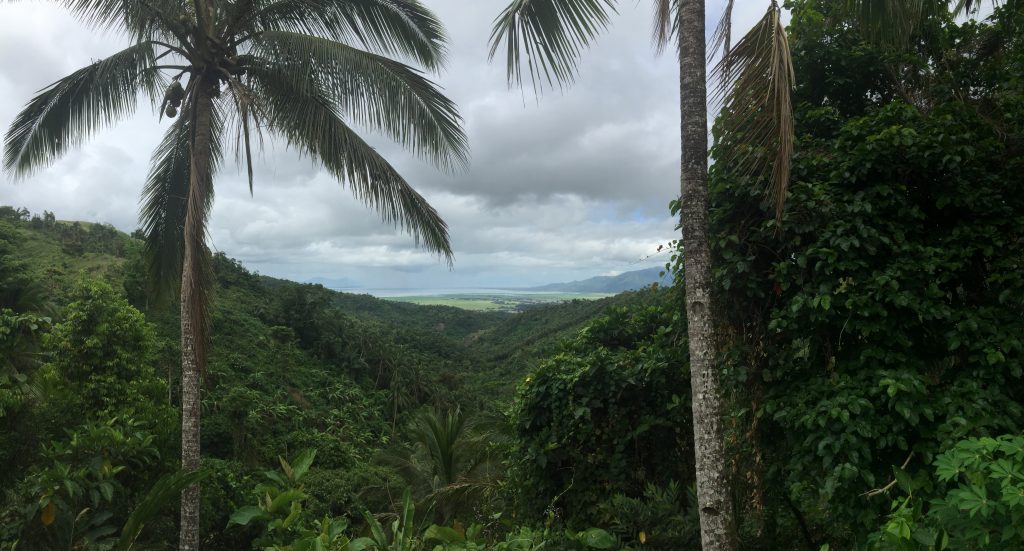
You get some very clear views right across Laguna de Bay and there were actually some good lookout areas.

This was a beautiful lookout point at Mt Romelo overlooking Laguna de Bay.
Buruwisan – A Majestic And Elegant Waterfall
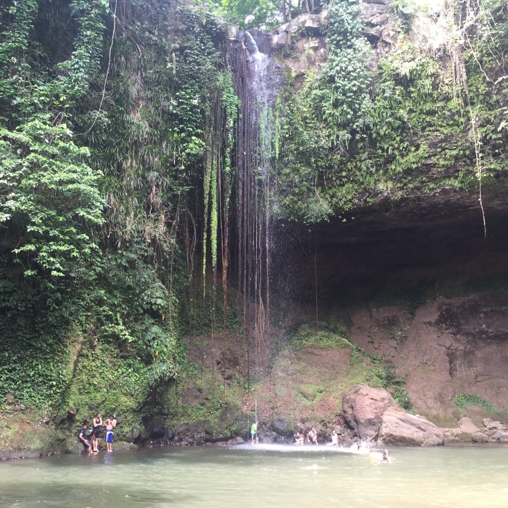
Our first stop was Buruwisan Falls. We reached this in about an hour and a half. This was a very high waterfall – probably about 30 metres high. It was surprising to see how many locals were there.
There were plenty of families having picnics on the banks of the basin at the bottom of Buruwisan Falls. As we were approaching the end of the dry season, the water flow wasn’t particularly strong.
This meant that the basin beneath the waterfall wasn’t very deep except immediately where the water hit from above. However, this didn’t deter us from jumping into the water and cooling off.

First stop was Buruwisan Falls. Although not the strongest flowing waterfall, it was certainly of the most elegant and majestic waterfalls I have seen.
After having a swim for about half an hour, we got out and sat on the rocks close to the waterfall and had our lunch. This was one of the more gentle waterfalls that I had been to and was almost a trickle.
However, the rock formations behind the actual waterfall and on the face of the cliff were unbelievable peace of nature.
Next Stop Lazones Falls
After relaxing for another half an hour or so we went around the next stop which was Lazones Falls. All you simply do is follow the river around the bend and follow the rapids. It’s only about another 10 to 15 minutes walk.
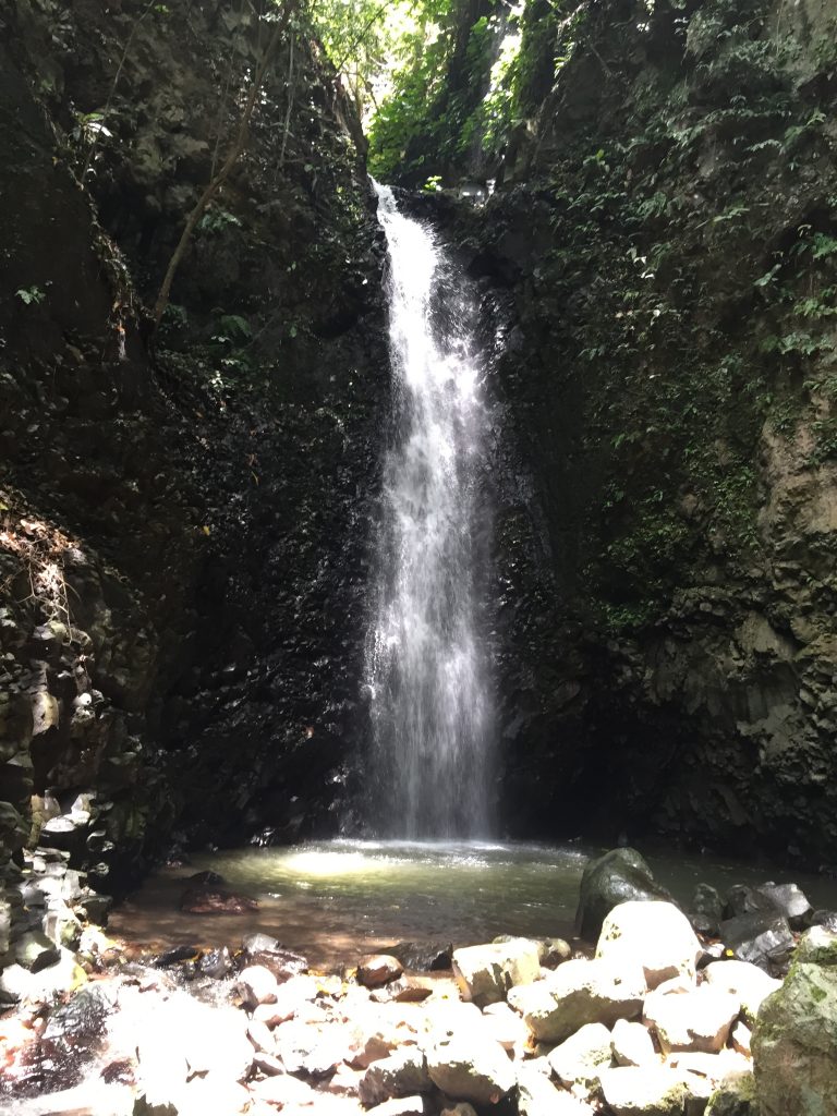
This was a very different waterfall compared to Buruwisan Falls. This waterfall was only about 10 to 15 metres high. However, the water flow was much stronger with this waterfall.
As there was no water flowing through this section, the water is definitely fresher and cooler. We stopped off here for about 20 minutes before continuing on to our final destination, Batya Batya Falls.

Our second stop for the day was Lazones Falls. This was certainly more powerful than Buruwisan Falls and the water was cooler and more fresh also.
Now was where the challenging part was. From Lazones Falls, you walk for about 10 to 15 minutes and then you hit the Siniloan river.
You need to cross the river on some makeshift rock and bamboo bridges and the path leads you to a gorge. from there if you want to get to Batya Batya Falls, you have no choice but to walk through the river up to about waist deep.
The river is full of boulders which makes it quite difficult to get stable footing.
You really need to take extra care here in maintaining your balance, if you are carrying a bag full of valuables such as mobile phones or other electronic devices.
Batya Batya Falls – The Most Difficult To Get To
After wading through the water for several minutes you end up reaching higher ground. We were greeted by a couple of groups of young Filipinos that were drinking brandy and beer.
Being typically friendly Filipinos, they warmly greeted us and shared their drinks. We could see that some of their friends were climbing up the cliff face and diving into the water below.
This looked fairly risky so we were quite content to sit on the rocks drinking some brandy. Batya Batya Falls is different to the first two waterfalls.
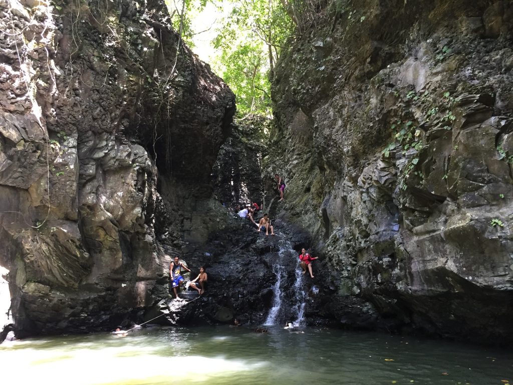
This one is more of a cascading waterfall as the water trickles down the rock face into the basin below. It is probably about the same height as Lazones Falls, approximately 5 to 6 metres.

Our final stop Batya Batya Falls. This area was very popular with cliff jumpers who were scaling the rock face to the top and then jumping into the water below.
After relaxing for about half an hour we decided it was time to head back. When you take the trail back you are not retracing your steps totally so at least you get to experience some different scenery.
The hike back to the car from Mt Romelo took just under 2 hours And we had well and truly worked up I thirst by then. As usual, we had a debrief while having a couple of beers before making our way back to Manila.
This was a great day of hiking without killing ourselves in the process and has grown on me as one of the best places in the Philippines just outside Manila.
In my next blog, we will look at the hardest hike I have ever done by a long way. We hiked to the summit of a dormant volcano that is yet to erupt.
This was a trek in which I narrowly avoided a very serious injury, or possibly even death. Make sure you keep your eyes out for the next instalment.
Fast Facts:
Google Maps – Mt. Romelo
Registration fee is P50 per head, and then the guide will expect a tip. P500 per guide is a fair rate.
As mentioned before, the landmark to look out for going to Mt Romelo is Trois Restaurant in Siniloan. This is on the Siniloan-Famy-Infanta Road, about 72kms from Makati or about 3hrs drive via R-5 Road.
From there the locals will direct you to the registration area and the entry point for the hike.
From what I have read, there is only one bus line that passes through the area. This is Raymond Bus Lines and the terminal is in Sampaloc, Manila. Take the bus bound for Infanta in Quezon Province.
The drop off point would be Trois Restaurant in Siniloan. Cost should be less than P200 one way. The trail can get quite muddy and slippery so it’s best to avoid hiking here during the wet season.
Best time of the year would be Feb/March. Horses are also available for P500 to take you to the summit and back if the track becomes too difficult.
Make sure you pack plenty of water, picnic lunch and snacks, swimming gear, towel and change of clothes. This area is quite remote with nothing really on offer aside from the natural beauty of the place.
If you enjoyed this article, please feel free to make comments below and share with friends and family. Please also check out my related articles below.
Related Articles:
Why You Should Try Hiking In Siniloan
Nagpatong Rock Travel Tips & Advice When Visiting
More Places in the Philippines:
Related Videos:


