Mt Makiling Hike Adventure
Written by Dezza, 13 December 2017.
Are you looking for a seriously challenging hike near Manila? If you are fit and an experienced hiker, then you should try Mt. Makiling in Laguna. Please continue reading for all the details.
For the last Deztiki day hike of 2015, we found ourselves in Los Banos Laguna, in Luzon Philippines. Our last adventure was also in Laguna but that was in Siniloan, which isn’t too far away from Los Banos.
For those that live in the Philippines and are familiar with Laguna province, you will know driving there you will see a large mountain at the end of the SLEX.
This is known as Mt Makiling. While this may not necessarily be one of the best places in the Philippines in terms of natural beauty, there is something special about it.
For years I have driven down the SLEX and have been fascinated by Mt Makiling. After doing some research about it, I learned that the Philippine Institute of Volcanology and Seismology (PHIVOLCS) classifies it as a volcano that is potentially active.
However, there has been no recorded eruptions as yet, hence, it is classed as dormant. This has always given me a strong incentive to hike to the summit before it erupts one day.
Mt Makiling also has many myths and legends written about it. As such, in recent times, it has become one of the best Philippines destinations for hiking adventures.
Let The Mt Makiling Adventure Begin
For our last hike to Mt. Romelo, we had five people. This time around we cobbled together eight for the hike itself. However, on this occasion, we had a slightly different setup.
We were fortunate that one of our friends was actually living nearby. He had also previously hiked up Mt Makiling on a couple of occasions.
So we made a bit of a day out of it by taking a group of about a dozen of us to our friend’s house. Then it was decided that the men would embark on the hike while the wives and girlfriends stay behind at our friend’s house.
In hindsight, this proved to be a pretty good decision as you will find out when you read more.
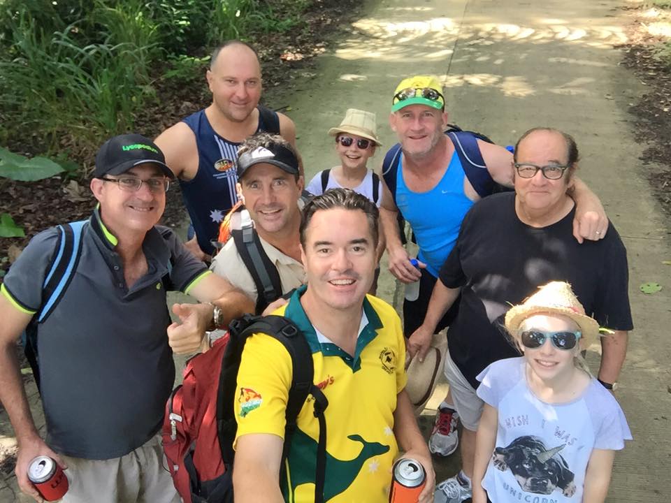
We started off as eight but only three of us remained by the time we got to the off-road trail.
Mt Makiling has three peaks and two major trails. One starts in a forest reserve known as UPLB College of Forestry and one in Brgy. San Miguel, Santo Tomas.
We used the UPLB trail as it is more commonly used, and this takes you to Peak 2. When you arrive at the registration area at UPLB College of Forestry, you aren’t permitted to drive through.
Therefore, you need to park your vehicle there.
The first couple of kilometres of the hike are along a sealed road. Once we got to the end of the road we had a change of personnel with five people deciding that was far enough.
Considering there were young children in the group this was a wise decision. With my friend’s house being pretty close, they all decided to return there and wait for us.
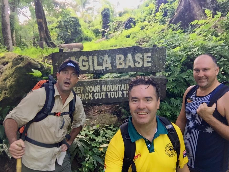
This was is about the halfway point in terms of distance, but not in time.
Now Or The Tough Part
This left three of us and this is where the real fun began. For the next couple of kilometres, there is a fairly well-defined trail that begins to gradually incline, and then the trail narrows and the incline becomes a lot steeper.
As we were near the end of the wet season, and because we were at such altitude, there was a lot of fog and mist around.
As we got closer to the summit, the trail got more slippery and steeper. By this stage, we were literally crawling up ledges with some clandestine bamboo rails to support us.
At this point, you often find yourself crawling on your hands and knees up slippery rocks.
When you get a couple of hundred meters from the summit, you have to contend with some clandestine ladders made from bamboo. These are there to help you negotiate some of the boulders that obstruct the trail.
These bamboo ladders are very slippery once they are wet and a lot of care needs to be taken.
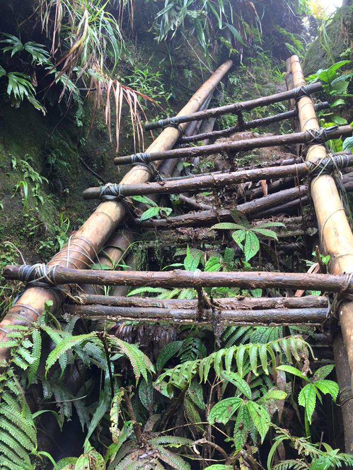
Climbing these bamboo ladders is a lot harder than it looks. To make matters worse, they get very slippery when wet.
Escaping Death
There was actually one part of the trail that was quite narrow and I lost my footing and fell backwards over a small ledge.
I was actually very lucky as I landed right next to a tree stump that was only a couple of inches wide and had a pointed end from where the rest of the tree trunk had snapped off.
I could quite easily have got impaled on this stump as I missed it by a matter of inches. As I was wearing my backpack, this might have helped me avoid serious injury if I had fallen on the stump, but was a very close call.
The next problem was that because of the angle I was laying on, my feet were above me and because of my backpack, I felt a bit like a turtle laying on its back. I wasn’t able to get any leverage to be able to pull myself up.
Luckily for me, my friends were there and were able to pull me back up. In a way, it was quite humorous, however, this tree stump could have caused some serious damage had I landed on it.
Battling Against The Elements
The other problem that you have to contend with on this hike is leeches that are just about everywhere. Just about every time you brush against a bush or shrub of some sort you end up collecting leeches.
They are not very big however there can be a lot of them. This is why it would be advisable to wear pants and long sleeve shirts.
After about five hours of slipping and sliding, blisters, leeches, cuts, scratches and almost pure exhaustion, we reached the summit. We really felt like we had conquered Mt. Everest!
All we needed was the music from the first Rocky movie when he reaches the top of the steps and triumphantly pumps his fists in the air. All in all, it took about five hours to reach the summit.
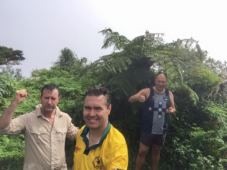
Celebrating our victory. Its a pity the weather wasn’t better as our views from the top weren’t great. This was, without doubt, the hardest hike I have ever done and we still needed to make it back!
Uh Oh – Now We Have To Go Back!
Unfortunately for us, the afternoon cloud that usually obstructs a clear view of the peak had rolled in. This meant that it was almost impossible to see any of the views around Mt Makiling.
However, we cracked a celebratory beer and stood around for about 15 minutes taking in what we could. This gave us enough time to psyche ourselves up for the trek back down.
The trek back down was almost as difficult as the trek up. A few passing showers had made the conditions very greasy. We really needed to concentrate on keeping my footing or else serious injury beckoned.
On the way back the mishaps continued with one of my friends losing the sole from the bottom of his shoe. We tried our best to do some running repairs but this didn’t work.
I happened to have a pair of flip-flops in my backpack so I suggested for my friend to wear them. However, they were getting stuck in some of the mud on the trail.
In the end, he decided to walk barefoot until the trail became less gluggy.
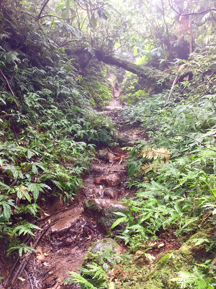
You can see that the trail is very undulating and with the rocks, it becomes very slippery when wet.
Finally, Some Good Fortune
The hike back from Mt Makiling took about four hours in total. When we got back to the sealed road we struck gold as we were lucky enough to hitch a ride from a helpful motorcyclist.
We were just about covered from head to toe in mud and were pretty exhausted. This was without a doubt the most challenging day hike I have ever done, much tougher than our hike to Buntot Palos Falls.
We looked and felt like we had just gone to war.
Next week we will look at our first hike of 2016 to probably the most beautiful waterfall I have ever seen.
This is certainly not a very well publicised waterfall but seems to be very well known by locals. So make sure you keep your eyes out for the next edition.
Fast Facts:
Google Maps: Mt. Makiling
Mt. Makiling is at the bottom of the SLEX and as you drive south down the SLEX you will see Mt. Makiling standing out in all its glory.
From Makati turn off at Calamba on the SLEX. All in all from Makati to the entry point at UPLB College of Forestry, it’s approximately 65kms and takes about 1.5hrs.
From Buendia, you can take a bus bound for Sta. Cruz in Laguna for approx P600. Get off at Los Baños Crossing near Robinsons Mall and then take a jeepney to UPLB College of Forestry. Cost should be less than P100.
Entry fee for Mt. Makiling is P10/person.
This is a very tough hike and should only be attempted if you are fit and have at least some hiking experience.
Make sure you bring some basic first aid, some band-aids, betadine, cotton wool, bandages, mostly just as a precaution, but there are plenty of ways to get scratches and scrapes along the way.
Also, bring plenty of water and some food and snacks to have along the way. I would strongly recommend good running shoes or hiking boots for this hike.
If you enjoyed this article, please feel free to make comments below and share with friends and family. Please also check out my related articles below.
Related Articles:
Buntot Palos Falls – Spectacular Waterfall In Laguna
Mt. Romelo – Epic Hiking Place Near Manila
Siniloan – Great Place For Hiking Near Manila


